Overview
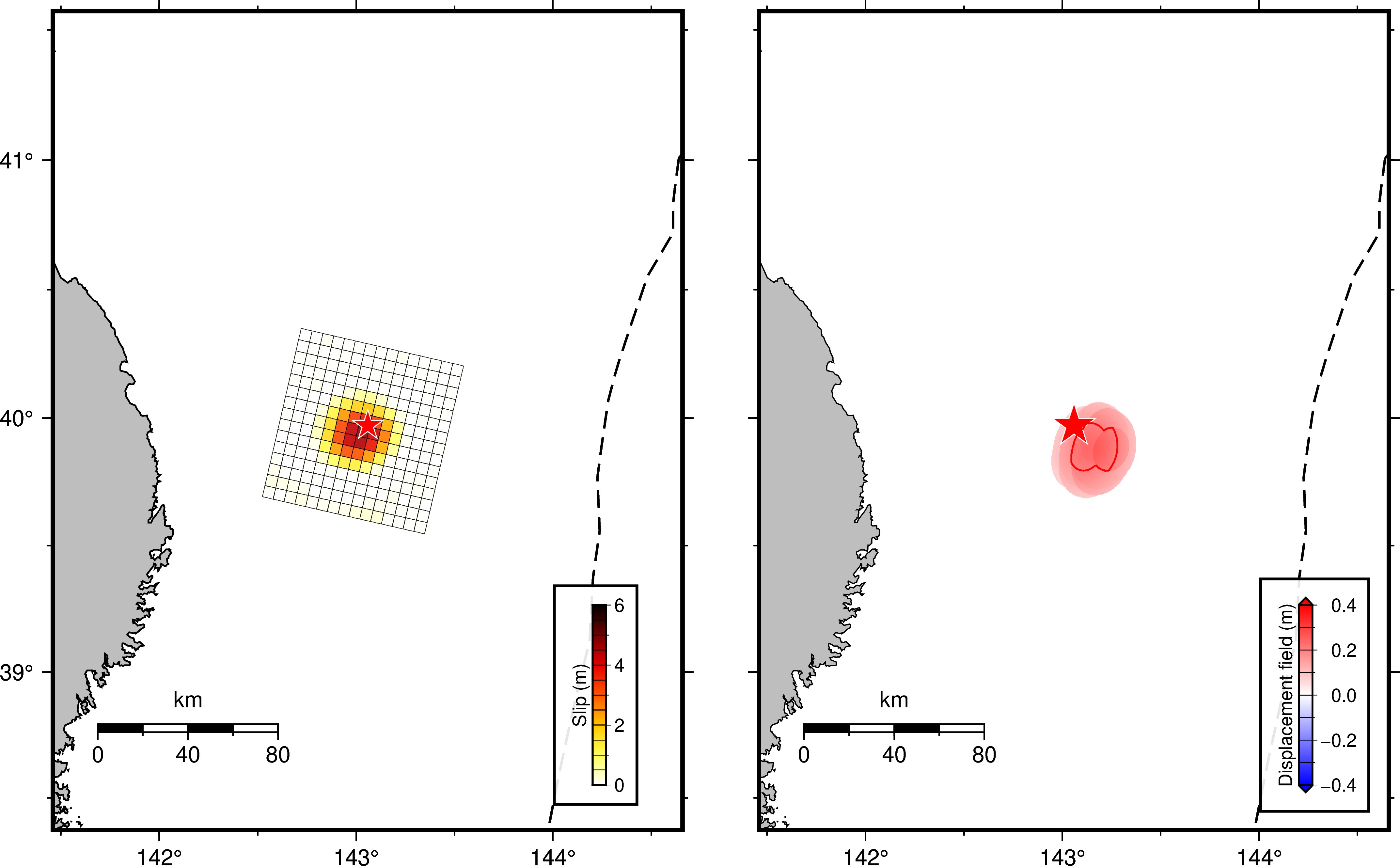
We have simulated the tsunami generated from the off Iwate earthquake (39.953°N, 143.046°E, depth = 35.0 km, M = 7.4 at 07:53:00 UTC according to USGS on Apr. 20, 2026. The tsunami source model is computed using the USGS finite fault model (Figure 1).
For the initial tsunami condition, static seafloor deformation is computed for a rectangular fault model (Okada, 1985) using the source models. The bathymetry data used are the 15-arc-second grid data from GEBCO 2025, which were resampled to a 9-arc-second grid. To simulate tsunami propagation, the linear shallow-water (long-wave) equations were solved numerically using a finite-difference method (Adriano et at., 2018)
Analysis & results
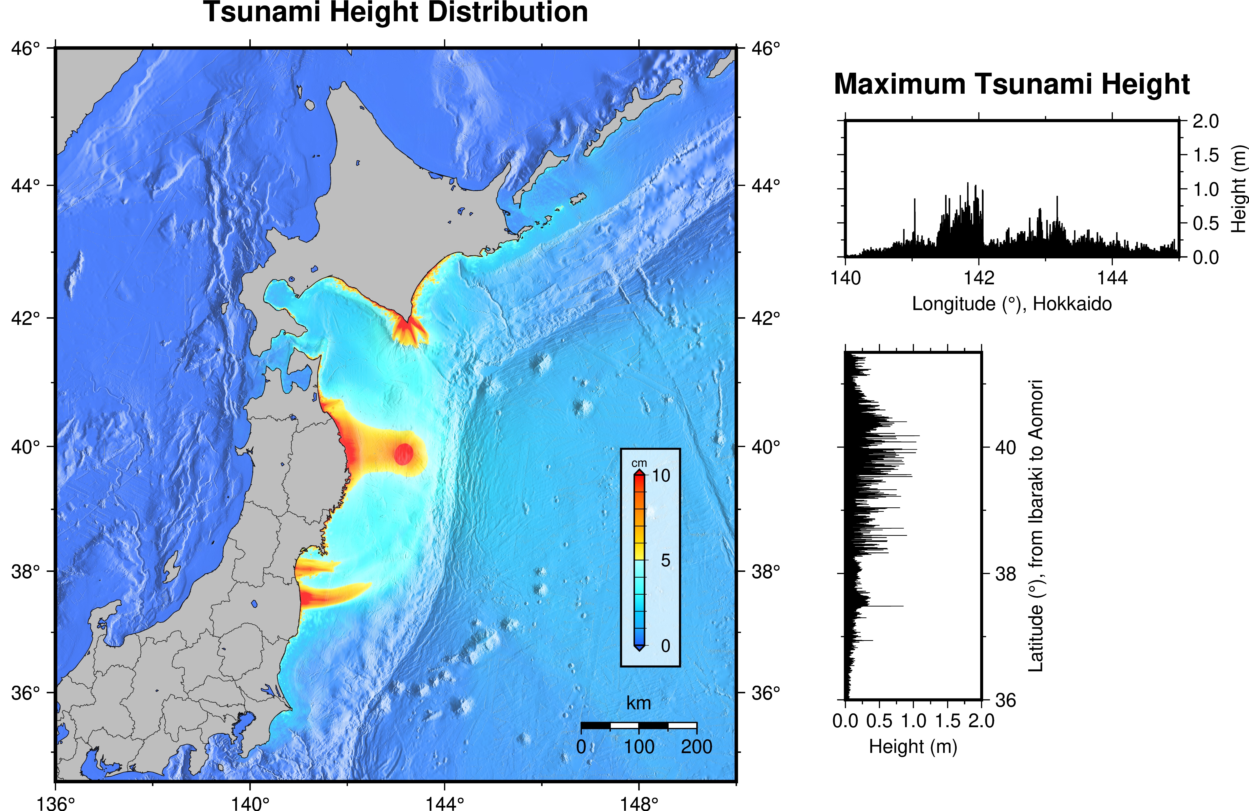
Figure 2 shows the maximum wave height distribution (tsunami energy) and the maximum tsunami height distribution at the coast. The tsunami propagation is shown in the following link.
References
- Okada (1985), Surface Deformation Due to Shear and Tensile Faults in a Half-Space, Bull. Seismol. Soc. Am., 75, 1135-1154.
- Adriano et al. (2018), Tsunami Source Inversion Using Tide Gauge and DART Tsunami Waveforms of the 2017 Mw8.2 Mexico Earthquake, Pure and Applied Geophysics, 175, 35–48.