JST LOTUS Programme · ASPIRE type · FY2026
GeoAI Framework for Hydrological Resilience in Intermontane Basins: Integrating AI and NbS Solutions
Our project has been selected for the FY2026 LOTUS Programme of the Japan Science and Technology Agency (JST). Kshitiz Agarwal, a PhD research scholar at the Indian Institute of Technology (IIT) Roorkee, will join our laboratory as an invited researcher for ten months. Combining geospatial AI (GeoAI) with Nature-based Solutions (NbS), the project builds a framework that turns hazard maps into actionable plans for where to place NbS, with Dehradun, a Himalayan basin city in India, as the main case and coastal Sendai as an exploratory one.
- Program
- JST LOTUS Programme, ASPIRE type
- Research period
- October 2026 – March 2028
- Research stay at IRIDeS
- February – December 2027
Japan-side Principal Investigator
Associate Professor
Disaster Geoinformatics Lab. (ReGiD), IRIDeS
Tohoku University,
Japan
India-side Principal Investigator
Mahua Mukherjee
Professor
Department of Architecture & Planning
Indian Institute of Technology
Roorkee, India
Invited Researcher
Kshitiz Agarwal
PhD Research Scholar
Department of Architecture & Planning
Indian Institute of
Technology Roorkee, India
← → to move between slides, N to open or close all summaries. 4 slides. Summaries were written from the slide content.
Project overview
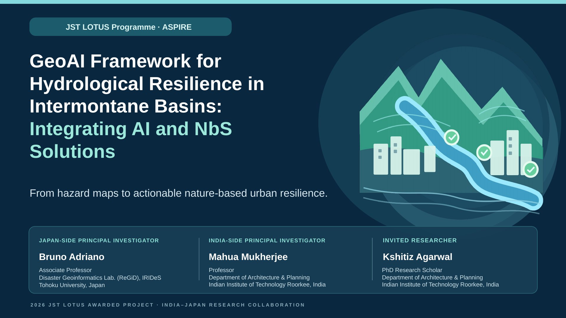
Slide summary
An India–Japan research collaboration under the JST LOTUS Programme (ASPIRE type). The project combines geospatial AI with Nature-based Solutions (NbS) to move from hazard maps to actionable, nature-based urban resilience.
The team: Bruno Adriano (Japan-side principal investigator, IRIDeS, Tohoku University), Mahua Mukherjee (India-side principal investigator, IIT Roorkee) and Kshitiz Agarwal (invited researcher, IIT Roorkee).
Research context — two hazard settings, one planning challenge
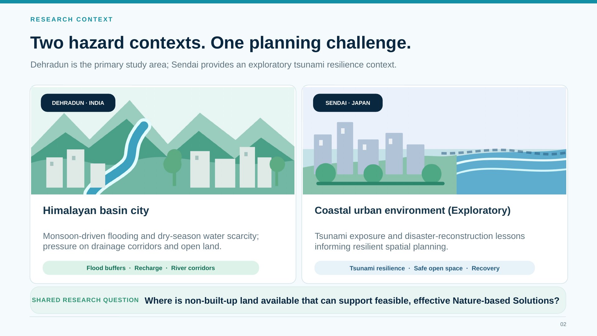
Slide summary
The project adapts one spatial-planning framework to two cities while respecting the distinct hazards of each.
- Dehradun, India — a Himalayan basin city facing monsoon-driven flooding and dry-season water scarcity, with growing pressure on drainage corridors and open land. Here NbS can act as flood buffers, support groundwater recharge and restore river corridors.
- Sendai, Japan — a coastal city exposed to tsunamis, whose reconstruction after the 2011 Great East Japan Earthquake offers lessons for resilient spatial planning: tsunami resilience, safe open space and recovery. Sendai is studied as an exploratory case.
Shared research question: where is non-built-up land available that can support feasible, effective Nature-based Solutions?
Research framework — five connected stages
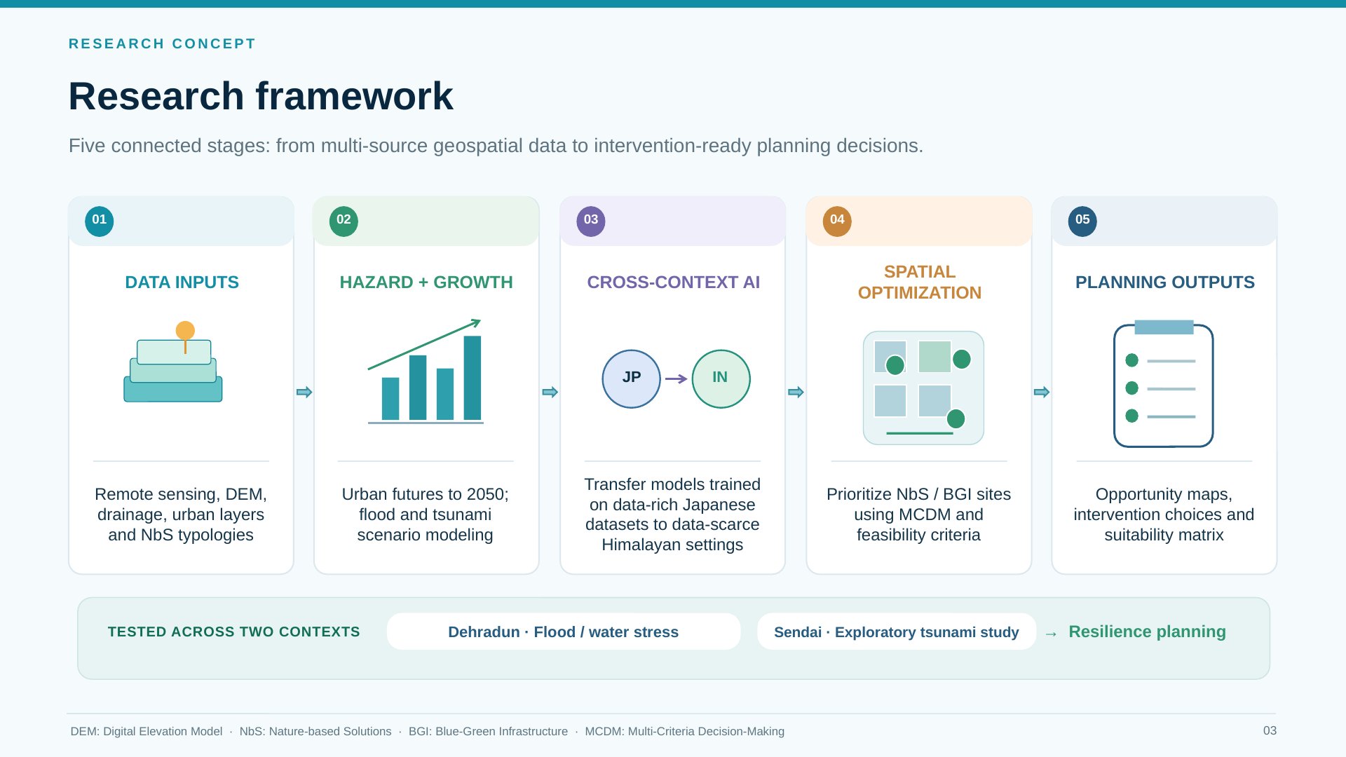
Slide summary
The framework moves from multi-source geospatial data to planning decisions that are ready for intervention.
- Data inputs — remote sensing, digital elevation models (DEMs), drainage networks, urban layers and a catalog of NbS types.
- Hazard and growth — urban growth projected to 2050, and flood and tsunami scenario modeling.
- Cross-context AI — transfer learning adapts models trained on data-rich Japanese datasets to the data-scarce Himalayan setting.
- Spatial optimization — candidate sites for NbS and blue-green infrastructure (BGI) are ranked with multi-criteria decision-making (MCDM) and feasibility criteria.
- Planning outputs — opportunity maps, intervention options and a suitability matrix.
The framework is tested in Dehradun (flooding and water stress) and Sendai (tsunami risk) to support resilience planning.
Research plan — from GeoAI prediction to NbS siting
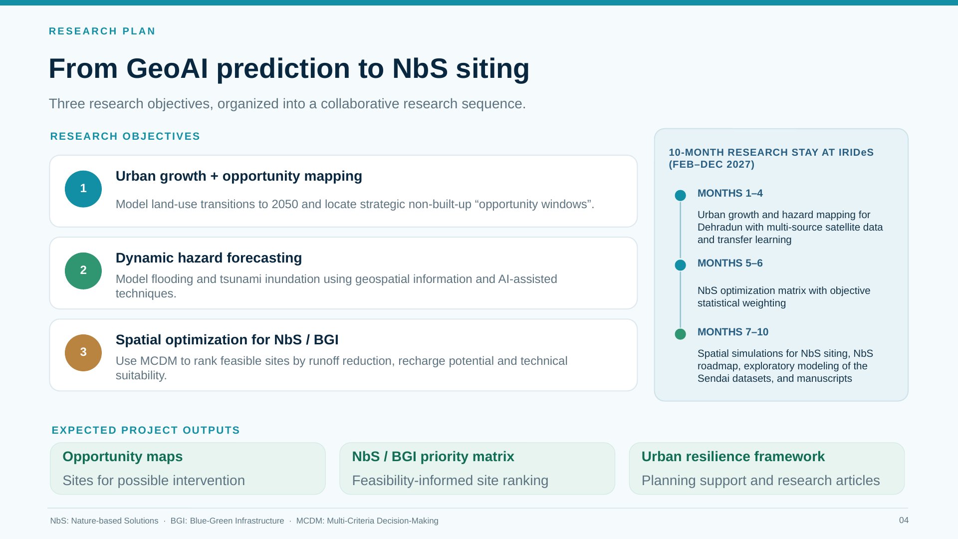
Slide summary
Research objectives
- Urban growth and opportunity mapping — model land-use change to 2050 and locate non-built-up “opportunity windows” where NbS could be placed.
- Dynamic hazard forecasting — simulate monsoon flooding and tsunami inundation using geospatial data and AI-assisted methods.
- Spatial optimization for NbS and BGI — use MCDM to rank feasible sites by runoff reduction, groundwater recharge potential and technical suitability.
Ten-month research stay at IRIDeS (February–December 2027)
- Months 1–4: urban growth and hazard mapping for Dehradun with multi-source satellite data and transfer learning.
- Months 5–6: an NbS optimization matrix built with objective statistical weighting.
- Months 7–10: spatial simulations for NbS siting, an NbS roadmap, exploratory modeling of the Sendai datasets, and manuscripts.
Expected outputs: opportunity maps of sites for possible intervention, an NbS/BGI priority matrix with feasibility-informed site rankings, and an urban resilience framework supported by research articles.
This research is supported by the Japan Science and Technology Agency (JST) through the LOTUS Programme (ASPIRE type).