Why remote sensing?
Observe impacts when access is difficult
After a disaster, field access can be dangerous, slow, or incomplete. Satellite data provide a repeatable way to observe large areas, identify changes, and guide response. Our work combines SAR and optical imagery with machine learning, GIS, and physical damage knowledge.
Deliver actionable information about where disasters strike and the severity of their impacts.
01 · Earthquake damage
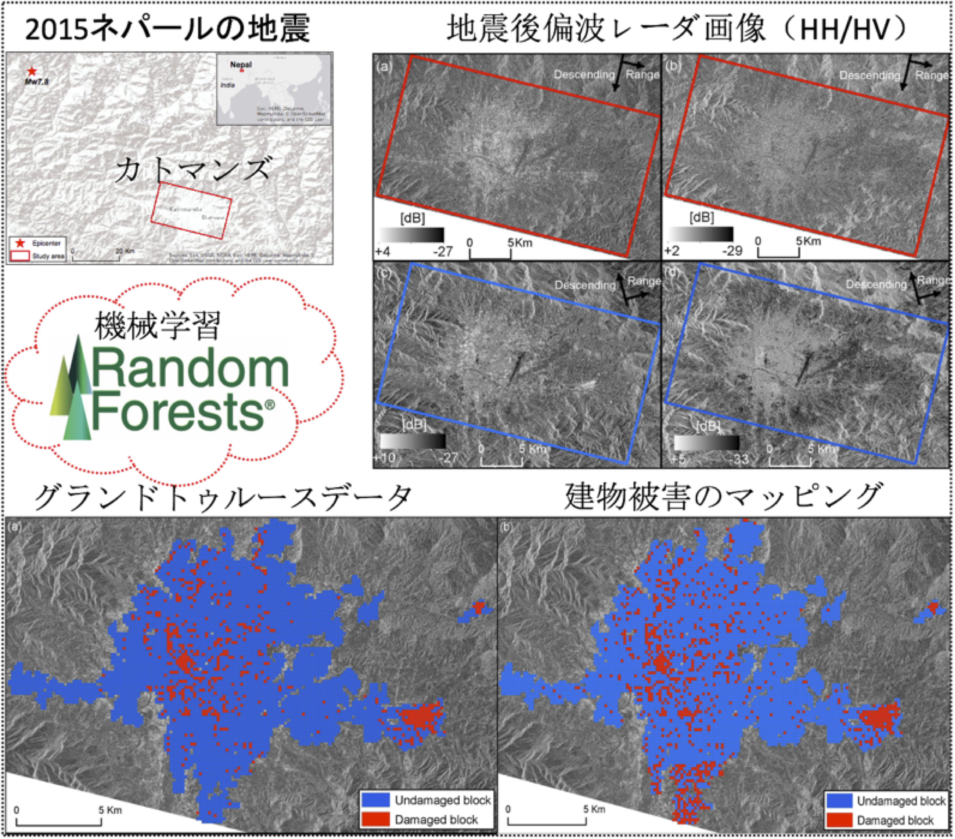
Building-damage assessment with polarimetric SAR
A single post-seismic dual-polarimetric ALOS-2/PALSAR-2 image can help distinguish slightly damaged, collapsed, and tilted buildings. Machine-learning methods were applied to built-up areas with different damage levels after the 2015 Nepal earthquake.
02 · Flood mapping
Extracting flooded urban areas from L-band SAR
SAR can support flood mapping even when clouds or darkness limit optical imagery. We developed methods to detect flooded areas in built-up environments using the September 2015 Kanto–Tohoku heavy-rain event as a case study.

03 · Multi-hazard integration
Rapid damage mapping for response
We combine SAR, optical data, built-up-area information, and machine-learning methods to detect collapsed buildings and flooded areas for emergency response. The goal is to provide reliable spatial information quickly enough to support prioritization.